The Roman age, in the Cispadan region between the
Apennines and the river Po, begins officially with the foundation of the
Roman colony of Ariminum (modern
Rimini) in 268 b.C. in a territory that already belonged to Celtic clans.
The furthest western territory, that included the greatest part of modern
Emilia Romagna, was definitely conquered by the Romans only after the
second Punic war (218-202 b.C.) and after long military
campaigns against the Galli Boi during the beginning of the 2nd
century b.C.
1.
The origins and development of the Roman town
»»
Bologna, a former Etruscan town, was founded in 189 b.C. as a Latin colony
and called Bononia. The origins of Claterna are not as known as those of
Bologna. Claterna was located 15 km east of Bologna and beside the
Etruscan origins it is quite probable the inhabited centre developed
during the 2nd century b.C. near the river Quaderna at the
south side of the Via Emilia. The development of the inhabited centre
coincided with a great agricultural colonisation of the plain that brought
many families and smallholders to settle in the area of Claterna.
At first Claterna was a village (perhaps a Conciliabulum)
with two main functions; the first was an itinerary function due to the
fact that the town stood at the crossing between the Via Aemilia and a transapennine road, probably the Via Flaminia
Minor. Both roads were Consular roads and were made in the same year
187 b.C. The second but not less important function was of economic and
social kind. Gradually Claterna became an exchange
and meeting centre for the population that lived in the productive
and densely populated surrounding area.
The status of urban town was appointed by the administrative autonomy,
when in the first century b.C. (during the Sillane period or maybe later
under Caesar) Claterna became a municipality and main town of a large
territory that stretched between the rivers Idice and Sillaro and bordered
with Bononia on its West Side
and with the Forum Cornelii
(modern Imola) on its East Side. Claterna
reached its greatest splendour at the beginning of the Roman Empire, as
stated by archaeological findings.
2.
The shape of the town
»»
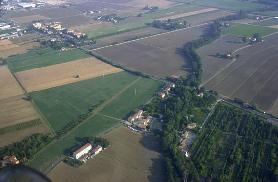
During the first century the town acquired a sharp outline that can still
be seen in the excavations. The urban area took a shape that reminded that
of a trapezium that stretched to the east and to the west for about 600
metres. It stood across the Via Emilia (that was also Claterna’s main
road decumanus maximus) and
stretched in both directions north and south for about 150 metres. At its
peak expansion the area was about 18 hectares wide, plus the suburban
areas that probably stretched for a few hundred metres along the main
roads.
The other main roads were a road that run along the river Quaderna with
different transition direction if compared to the prevailing system
of the time; a large road that was orthogonal to the Via Emilia (the cardo
maximus) and finally two roads parallel to the cardo
maximus. The two parallel roads were respectively in the north part
and in the south part of the town. The urban plant was defined by the
river Quaderna on the East Side and by the small Gorgara to the west.
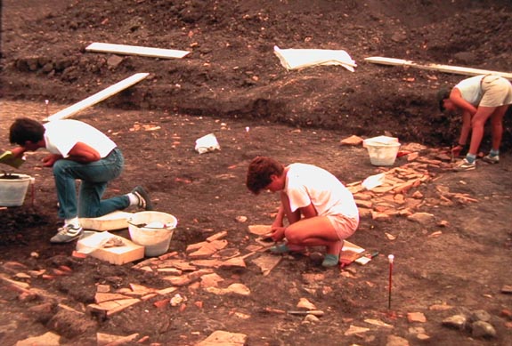
Other records have been reconstructed through archaeological
investigations based on data collected during systematic land surveys,
through the analysis of air photography and from the application of
geophysics methods and finally by excavations.
The urban plant was the result of a mixture of blocks of different shapes
and lengths, which denotes a spontaneous origin (the ancient Conciliabulum)
that alternates with planned interventions occurred at the time when
Claterna received the official appointment of local administration centre.
The roads were made with simple layers of pebble whereas in Bononia
and in Forum Corneli
were found large pieces of pavement made of polygonal shaped
stones.
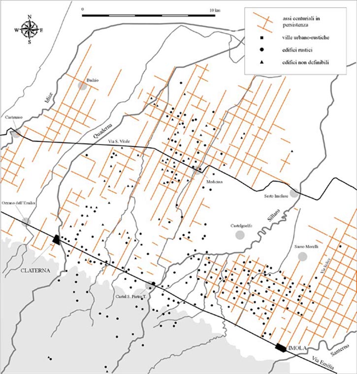
It is also important to point out that the shape of the town was closely
related to the territory. The main roads consisted in the extensions of
the centurial limits, i.e. the roads that through a regularly shaped
square net of about 710 meters per side connected the whole plain deeply
influencing its form and general structure.
3.
The outlines of the town and its outskirts
»»
As every Roman town, Claterna had its core centre in the forum, that was
the marketplace and the seat of the main urban functions. The forum was
discovered in the 19th century in the east part of the town. It
resulted from an enlargement and prolongation of the Consular road Emilia.
Nothing was found regarding other public spaces or buildings such as
temples, however some ancient inscriptions were found (epigraphs) that
give evidence of the existence of temples in the area.
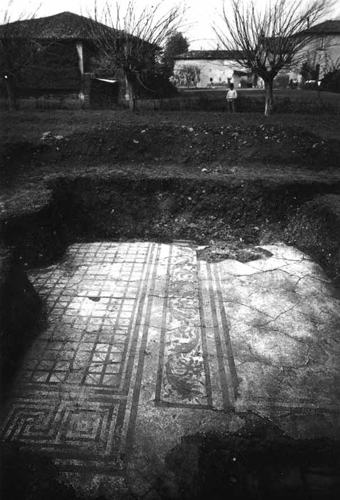
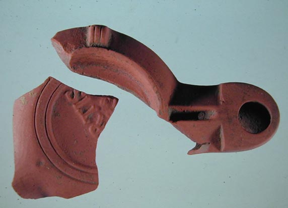
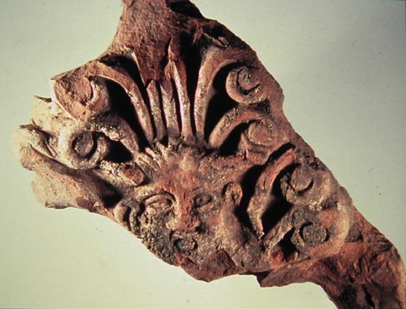
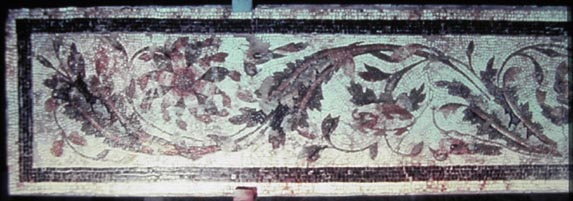
Many evidences of domus have
been found. The domus were the
houses of rich people and their rests often show the classic scheme of the
atrium, typical of the Roman tradition. The rooms had beautiful
floors made with mosaics or ordinary brickwork as well as tubs and large
inner yards with open areas and porticoes. Recent excavations (carried out
in the 80s and 90s) have also shown modest buildings as part of a various
and large social concentration. These buildings show simple earthen floors
and layers of perishable material such us wood or clay.
The suburb were outside the urban area. The necropolis could be found
along the connecting roads. Some necropolis contained real funeral
monuments as well as manufacturing and service areas. As an example in the
eastern outskirts of the town, beyond the river Quaderna recent
excavations have produced evidence of structures for the processing of
glass and iron, beside some processing related buildings and a post
station (mansio).
4.
Outlines of the territory
»»
As for the greatest part of Padanian Italy the Roman colons divided the
territory at the moment they took possession of the land.
The net denominated Centurization consisted in a myriad of roads and
canals that drained the ground and facilitated the flowing of waters. The
Roman land surveyors in a short time built the net. Every mesh was 710
meters long and in turn it was divided in small regular pieces that were
assigned to the families. The signs of that impressive work are still
impressed in the territory of Emilia Romagna and in the greatest part of
Ozzano’s territory.
The Centurization had then multiple functions: It formed an excellent
communication net, it was a draining system and at the same time an
irrigation system. Finally it was a reliable tool for the property and
land-registry that recorded the owned land exactly as in present days.
In the centurizated plain as well as in the areas near the hills and on
hills the prevailing settling system consisted in scattered buildings,
farms and villas mostly regularly distributed. These structures imply the
dominant economic presence of small and medium holders. Large estate were
non very common and were characterised by villas with large processing
areas and food stocking. Large parts of the main villas belonged to the so
called pars urbana, i.e. house
of rich owners and therefore richly decorated with mosaics and frescos.
The peak of land production was between the first and the second century
b.C. with the flourishing of the Italian economy. Production consisted
mainly in cereals and wine that were also exported in amphorae.
5.
The town in the written sources
»»
Claterna enjoys a relatively rich historical documentation. First and
foremost it must be underlined the fact that the town takes its name from
the nearby river, which indicates ancient origins. Moreover the name’s
suffix (i.e. the final part of the name) ends in -na is probably of
Etruscan origin. As it often happens with many other centres in central
and northern Italy.
Cicero mentioned the town in reference to the “war of Modena”. In the
year 43 b.C. Aulus Irtius, who settled in it reinforcing the position of
Octavianus against Antonius, conquered it. Beside the historical
implication, this episode denotes the presence of a defence structure
around the town that was not necessarily made of thick walls but
presumably by a simple rampart and earthwork.
Other written sources to be mentioned there are the inscriptions (epigraphs
on stones) found on the territory and during the town excavations. There
are honorary inscriptions for important people and emperors, but also
dedicative inscriptions where the names of divinities are mentioned.
Toward the end of the 5th St. Ambrogius, the Bishop of Milan,
also mentioned Claterna. It was included in a list of centres of our
region that were in a poor state: “semirutarum
urbium cadavera” he said.
|